Living on the sinkhole plain: what karst means for a Bowling Green foundation
Bowling Green drains through caves. The city has few surface streams and sends much of its stormwater underground on purpose. That makes this one of the more interesting places in the country to own a house, and one of the more important places to understand what is under it.
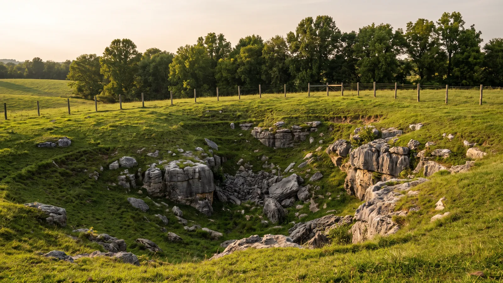
Karst is ground made of soluble rock, here limestone, that slowly dissolves along cracks into caves, conduits and sinkholes. More than half of Kentucky lies over karst, according to the Kentucky Geological Survey, and Bowling Green sits squarely on the Pennyroyal sinkhole plain. Rain falls, runs into sinkholes and drainage wells, and travels through cave passages rather than across the surface in creeks.
The cave under the south side
Lost River Cave, at Nashville Road and Cave Mill Road, is the best-known window into that system. The state describes a 68-acre valley owned by Warren County Fiscal Court, formed when the cave entrance collapsed, with a cave system that drains about 85 square miles. The river surfaces in four blue holes, and Ripley's once called it the shortest and deepest underground river, supposedly 437 feet deep. The cave runs nearly 60 feet below US 31W, and it hosts the state's only underground boat tour, which heavy rain can cancel.
How the city handles stormwater
Because so few streams cross the city, Bowling Green's stormwater program uses drainage wells and "improved sinkholes" to inject runoff into the caves. The EPA classes those as Class V injection wells. The city lists their usual problems as clogging, sinkhole collapse and contamination. In practical terms: water that lands on your street may be headed straight down into rock not far from your footing.
Not every neighborhood is the same
After the April 2025 storms, city geologist Nick Lawhon explained the difference across town. North of the river, the land sits 90 to 200 feet above it with caves about 150 feet down, so water drains deep. On the northwest side, along the Russellville Road and Nashville Road corridors, groundwater is shallow and cave passages are often 15 to 20 feet or less below the surface. He also noted that wet clay topsoil gets heavier and weaker. A house on the northwest side and a house on the high ground north of the river can show the same crack for different reasons.
A short record of the ground moving
- February 12, 2014Motion detectors alerted the National Corvette Museum's security company at 5:44 a.m. A sinkhole had opened under the Skydome, about 40 feet wide, 60 feet long and 30 feet deep, swallowing eight Corvettes. No one was hurt. A WKU geologist attributed it to karst.
- March to April 2014The cars were recovered. Some were later restored; others are displayed as they came out.
- July 2015The repaired Skydome reopened.
- February 2016The museum opened its "Corvette Cave-In" exhibit about the collapse.
- April 2025More than ten inches of rain in about four days. The city responded to at least 18 new sinkholes, about 11 of them its own to repair; the rest were on county, private or commercial land. A stream on Russellville Road that normally runs about three inches deep was measured at about 12.5 feet.
How karst reaches a foundation
Most houses never meet a dramatic collapse. The common karst problem is slower. The Survey describes soft residual clay settling gradually under heavy structures, and water carrying supporting soil down into voids in the limestone. The result is a footing that loses support at one spot, a corner that drops, a slab that sags over a soft pocket, or a crack that grows after every wet season. Heavy storms can also overwhelm the underground conduits and flood low areas, which the Survey calls sinkhole flooding.
Warning signs worth a call
- A depression forming in the yard, especially one that holds water after rain or grows over weeks
- Soil dropping along the foundation or around a downspout outlet
- New cracks concentrated at one corner or one section of the house
- Doors that start sticking all on one side
- A sidewalk, patio or driveway slab tilting toward a low spot
What we can do, and when an engineer is needed
For a house losing support over soft ground, piers can carry the load past the clay to firmer bearing, and drainage changes can stop roof and yard water from concentrating where the ground is weakest. That covers most of the karst-related work we see. An open or active void beneath a house is different: the Survey recommends site evaluation with geophysical studies and core sampling, and filling or grouting a void is engineered work. When a job reaches that point, we say so and bring in an engineer before anyone pumps anything into the ground.
A new hole on public land such as a street, right-of-way or drainage easement goes to Bowling Green Public Works at 270-393-3628. Keep people and vehicles away from the edge; sinkholes can be wider underground than at the surface.
Insurance and karst
Standard homeowners policies typically exclude earth movement, including sinkholes, and the Survey recommends insurance for homes on karst because hidden caverns are hard to detect. Some insurers offer sinkhole coverage as an endorsement. Our insurance guide covers what to ask.
Questions readers send us
Is my house more likely to fall into a sinkhole because I live in Bowling Green?
Dramatic collapses under homes are rare. The far more common effect of karst is slow loss of support under part of a footing, which shows up as settlement and cracking. Watch for depressions, soil loss beside the foundation and cracks concentrated at one spot.
Can I fill a small sinkhole in my yard myself?
Pouring dirt into a hole that keeps reopening often just feeds the void. If it is near the house, have it looked at first. If it is on public land, report it to Public Works.
Do drainage wells near my house cause problems?
They are part of how the city manages stormwater. Problems the city itself lists include clogging and collapse. If a well near you clogs or the ground around it drops, call Public Works.
Can piers reach solid rock everywhere?
Piers are driven to a depth that carries the load, which on karst can differ from one corner of a house to another. That is why we record the depth and pressure at each pier.
Who studies the karst here?
The Kentucky Geological Survey maps karst statewide, and WKU's Crawford Hydrology Laboratory does fluorescent dye tracing of karst groundwater.
Keep reading: Sinkhole and karst repair · Push piers · Clay soil guide · Insurance guide